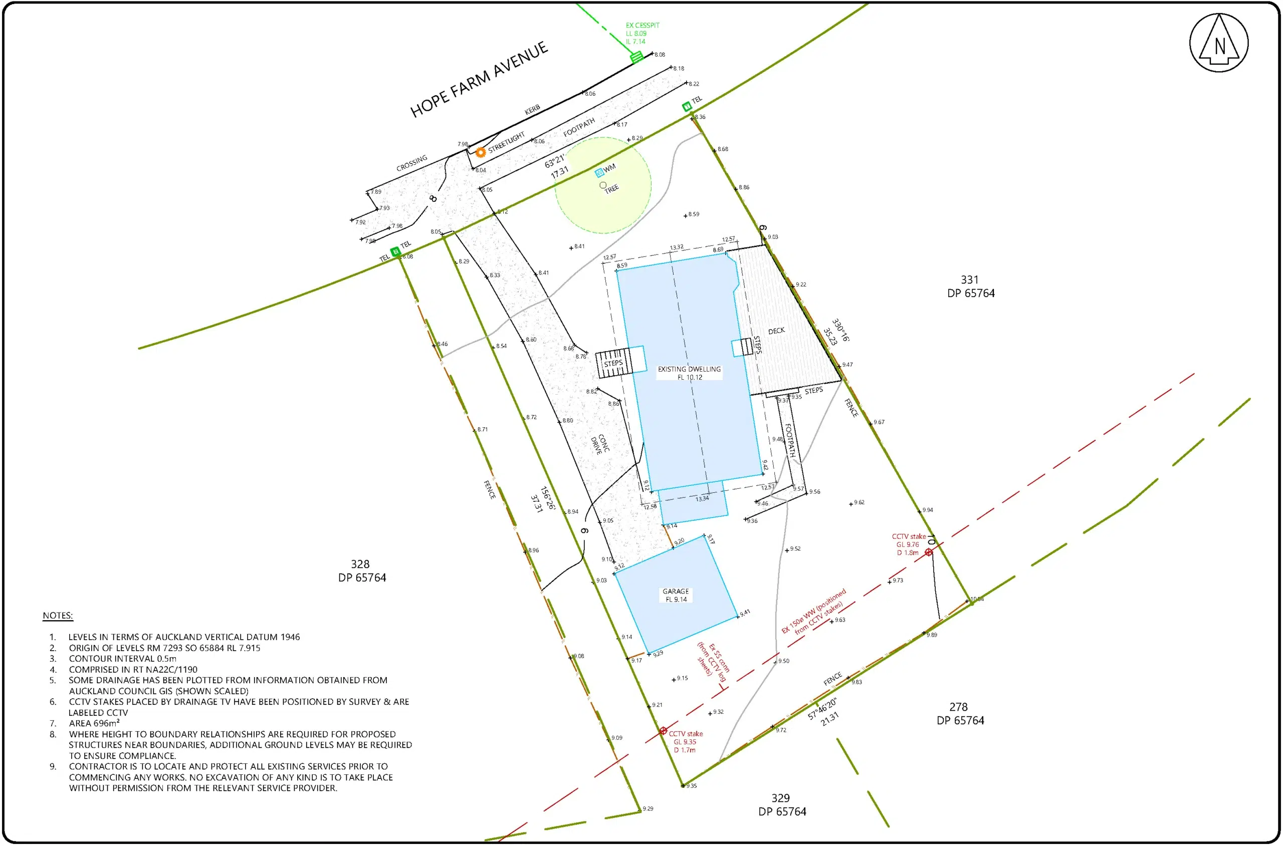
A topographical survey is crucial for various reasons, especially for construction, engineering, and land development projects. Here are some key reasons why getting a good topographical survey is important:
Accurate Representation of the Land Topography:
A topographical survey provides an accurate and detailed representation of the natural and man-made features of a specific piece of land. This includes contours, elevations, slopes, trees, bodies of water, buildings, and other significant features.
Design and Planning:
Engineers, architects, surveyors and planners use topographical surveys to create accurate and detailed site plans. This information is crucial for designing structures, roads, drainage systems, and other elements of a project. It helps in optimising the layout of the proposed development based on the existing conditions of the land.
Risk Assessment:
Understanding the topography of a site is essential for assessing potential risks and challenges associated with a project. This includes issues such as flooding, soil stability, and other geological factors. Identifying these risks early in the planning phase allows for appropriate mitigation measures to be implemented.
Construction:
Construction projects often require precise grading and levelling of the land. A topographical survey provides the necessary data for determining the best way to grade the land to ensure proper drainage, stability, and adherence to local building codes.
Utilities and Infrastructure Planning:
Topographical surveys are essential for planning the installation of utilities such as stormwater, water, sewer, and power. The accurate mapping of existing features helps avoid conflicts with underground infrastructure and ensures proper integration into the overall project design.
Environmental Impact Assessment:
In environmentally sensitive areas, a topographical survey is crucial for conducting environmental impact assessments. It helps identify and evaluate potential environmental impacts, allowing for the development of strategies to minimise negative effects.
Legal Requirements:
Many local authorities and regulatory bodies require topographical surveys as part of the planning and permitting process for construction and development projects. Compliance with these requirements is essential to avoid legal issues and delays in project approvals.
In summary, a good topographical survey is a fundamental step in the planning and execution of various projects, providing accurate data that helps optimise design, assess risks, and ensure compliance with regulatory requirements. It is a valuable tool for making informed decisions that contribute to the success and sustainability of development projects.
We offer a wide range of surveying services at a reasonable cost; whether you’re planning an extension for your house or obtaining Unit Titles for your completed commercial building, you almost always need the expertise of a surveyor.


